Hiking to Contour Falls: One of Cuyahoga Valley's Best Kept Secrets
- Dan Wagner
- Feb 2
- 3 min read
Updated: Feb 8
Hiking out to Contour Falls in Cuyahoga Valley National Park feels like discovering a secret the park never quite advertises. Tucked deep within a steep ravine, the falls are framed by towering hemlocks and rugged rock walls, a world away from the crowds that define other parts of CVNP. The hike itself isn’t difficult, but in the warmer months, staying dry is nearly impossible. That’s exactly why Contour Falls shines in winter, when frozen ground and icy conditions turn the approach into a far more enjoyable—and memorable—experience.


Trailhead elevation 625'
Water seasonal from the ravine
Don't miss hiking down the right ravine!
Hiking to Contour Falls
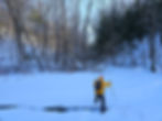
After more than two weeks of temperatures hovering at or below zero in the valley, I pull into the Station Road Bridge Trailhead hoping to find Contour Falls frozen solid. I’ve hiked out to the falls several times after heavy rain, when the water is surging, but winter promises an entirely different experience. After recently hiking out to a frozen Twin Sister Falls, I like my chances that Contour Falls will be just as great under a deep freeze.

From the trailhead, I cross Station Road Bridge, which links Cuyahoga County and Summit County at the Pinery Narrows—the narrowest stretch of the Cuyahoga River gorge. As I look down at the river, I can’t help but think that if it hasn’t frozen after two straight weeks of brutal cold, it probably never will.


On the far side of the bridge, I turn left onto the Towpath Trail and head north. Before long, I pass a bench and cross a small footbridge where the unofficial path to Twin Sister Falls begins.

A few hundred yards later, Mudcatcher Falls comes into view on my right, marking the head of the ravine that hides Twin Sister Falls farther upstream.

Winter Storm Fern recently dumped more than a foot of snow across the valley, but the well-packed line of footprints along the Towpath suggests it hasn’t kept many hikers at home.

At 1.15 miles from the trailhead, I reach the second ravine, its entrance stamped with dozens of footprints from hikers searching for Contour Falls. They’re in the wrong place, I think to myself. About 400 feet beyond that ravine—near coordinates 41.333247, -81.588791 and just before mile marker 16—I arrive at the third ravine and step across the frozen canal. Just a half mile north of here, tucked into a much trickier ravine to navigate, are Raccoon Falls and Ramona Falls—two even less visited waterfalls within the park. But today, my focus is on Contour Falls.
Once inside, the route quickly turns into a steady rhythm of navigating around, over, and under fallen trees. None of them are especially difficult, but there are plenty of them. Thankfully, after two weeks of frigid weather, the stream winding through the ravine is frozen solid.


The ravine twists and turns every few hundred feet for roughly three-quarters of a mile, and it's incredibly beautiful this time of year. The sun even came out for the first time in like three weeks.

At 1.9 miles, I finally reach Contour Falls, a forty-foot cascade now locked in ice. It’s completely frozen and, truthfully, not as photogenic as it is in warmer months after heavy rain—but it’s still an impressive sight.

The falls are also known as Sulfur Falls, a nod to the sulfur spring farther upstream. Most locals refer to it by that name, though others know it as Contour Falls, which becomes easier to understand once the water is flowing freely in warmer weather. I've even heard of it being referred to as Cooks Falls.


I stay for about half an hour, eating lunch and soaking in the silence before heading back the way I came. On the return, I take my time, enjoying the scenery—mature hemlocks adding a splash of green to an otherwise bare hardwood forest. It’s a beautiful hike, one I’ve done many times and will continue to revisit for years to come. Maybe next time, mid-October to capture the fall colors.


