Dan Wagner
Eleven Incredible Days In Colorado
Colorado, where the Rocky Mountains soar over the Great Plains. A land with more high peaks than any other state, imposing canyons and towering mountains of sand. Eleven Incredible Days in Colorado takes you on a journey around the centennial state where you'll experience one beautiful adventure after another. From summiting the tallest peak in the Rockies to soaking in naturally formed geothermal hot springs, you'll get a true taste of what Colorado is all about. This guide is geared towards the experienced adventurer willing to take on big miles and significant elevation gain. Late June is a great time of year to tackle this one when temps are fairly warm and the mountain peaks are still snow covered. A high clearance vehicle is required for this adventure.
The map below illustrates nearly all of the stops on this adventure and clicking on each waypoint previews the photos found throughout the article.
Day 1: Loveland Pass
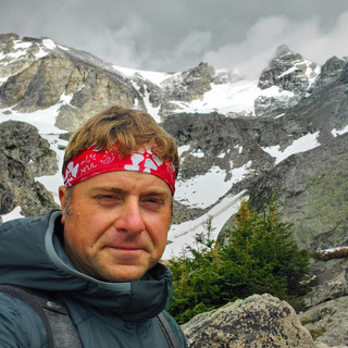
Mount Sniktau, Cupid & Grizzly Peak (8.2/3,500')
Today begins along the Continental Divide at Loveland Pass in the Colorado's Front Range. Trailhead parking is on either side of the highway at the Loveland Pass sign and accommodates between 25-30 vehicles. The trail begins on the side of the road opposite the pass sign. You're immediately welcomed with a 1,000-foot ascent to an obvious split in the trail. Go left and ascend another 500 feet to summit Mount Sniktau (13,240') and your first 13er. From here you'll have a great view of Grays (14,278') and Torreys Peak (14,267'), two popular 14ers, to the southeast. During your descent, pass the split you took a left on to get up to Sniktau and continue another 0.75 miles to summit Cupid Peak (13,117') with little effort. Continue past Cupid, descending along the left-ish side of the peak. If deep snow is still present descend along the right and cross the boulder field along the saddle before reconnecting with the trail again. Next, begin your ascent to summit Grizzly Peak (13,988'), the highest peak not a 14er in the state. Many people summit Sniktau and Cupid and call it a day, but some of the best views are from Grizzly and during your descent from Grizzly. Mountain goats are very common near the summit so keep your eyes peeled.

To put yourself in good position for tomorrow, Granby is a good place to stay. Sunset Point Campground on Lake Granby's eastern shore puts you 15 minutes from tomorrow's trailhead, but no electricity or showers and is first come, first served. Granby has plenty of restaurants. Pop's Pizza has a solid BBQ chicken pizza and a surprisingly good Philly. Two Pines Supply is a cool local outdoors store and City Market is the local grocery store.
Day 2: Indian Peaks Wilderness
Cascade Creek to Mirror Lake & Crater Lake (16 miles/2,500')
Easily one of the top few hikes in all of Colorado and for good reason. Beautiful cascading waterfalls, dense spruce and pine forest, abundant wildflowers, wildlife and the showstopper, Lone Eagle Peak, a stunning 11,946' granite peak towering over pristine Crater Lake. Arguably the most iconic mountain peak in all of Colorado. A before sunrise start is recommended to beat the crowds and have the best opportunity to view moose around Monarch Lake. Several trails begin at the Monarch Lake Trailhead, but for this hike you'll be using the Cascade Creek Trail that runs along the left of Monarch Lake. Shortly after the lake you'll enter a forest setting, steadily gaining elevation with Cascade Creek below you to the right. Two waterfalls lie ahead, the first around 3.5 miles and the second and more notable around 4.5. About 8 miles in you'll arrive atop a fairly large granite slab with Mirror Lake to your right. From here, take a right down the stone slab and continue along the edge of the lake until reaching the back (north) side of the lake. Doing so will give you an incredible view of Lone Eagle Peak seen below.

Many hikers call it a day here and turn back. We recommend continuing another quarter mile or so, crossing the steam connecting Mirror Lake to Crater Lake, and exploring the shore and cliffs along Crater Lake. There's a bunch of great spots to dip your sore feet in the crystal clear, frigid water.

Along the shore to the left offers a number of really great views. Enjoy the well earned rest and return the way you came. Black bears aren't uncommon along this trail, so bear bells are a good idea. The last time we hiked this we saw three bears no more than 20' off the trail about 7 miles in.
At this point you'll have to make a decision on where to sleep for the night. Two decent options are Wolcott Campground and Gypsum Campground 17 miles further west on I-70 in Gypsum, both Bureau of Land Management campgrounds along the Eagle River. The primitive sites are each $10/night, first come, first served and around two hours from Monarch Lake. Either of these campgrounds will leave you roughly 1.5 hours from tomorrow's next trek. The rub with the campgrounds is they fill up pretty early and have no showers, so having an Airbnb, hotel or reservable campsite somewhere else is probably the better option. If you choose the latter route, Glenwood Springs and the tacos at Slope & Hatch are a no brainer.
Day 3: Glenwood Springs
Glenwood Canyon Whitewater Rafting
Doc Holliday Grave (0.75 miles/200')
Penny Hot Springs
Hayes Creek Falls
Crystal Mill
Water is today's theme beginning with a Blue Sky Adventures rafting trip along the Colorado River through spectacular Glenwood Canyon and Shoshone Rapids. Several trip options are available, but opt for their Half Day Adventure, a 3-4 hour raft down with more agreeable launch times compared to some of their other trips. If you're able to snag an early launch time and are looking for a good lunch spot after, the stout beef chili at Glenwood Canyon Brewpub is excellent. Four short blocks away from the brewpub is the Doc Holliday Grave Trail, a three-quarter mile trail leading you to where the real deal Doc Holliday is buried. History buffs can't pass this one up. Bring a bandana.

Next, a short drive south brings you to Penny Hot Springs, a naturally fed hot spring accommodating roughly ten people along the Crystal River. The easy to spot parking area is on the east (left) side of the road. Winter snow melt can cause the spring to flood, so summer and fall are the best times to enjoy. Expect some folks to be in their birthday suits.
After relaxing a bit in the hot springs head five miles south to Hayes Creek Falls, a gorgeous 40-foot multiple cascade waterfall located roughly 100' from the road. Park along SH-133 and make your way to the base of the falls after enjoying the view from above.

Thirty minutes southeast of Hayes Creek Falls rests the drop dead gorgeous Crystal Mill, the last stop of the day. The Sheep Mountain Power House as it was originally known was built in 1892, abandoned in 1917, and has become the most photographed landmark in all of Colorado. The unpaved road leading up to the mill is shared between hikers and high clearance vehicles, so expect minor delays.

There are several camping options somewhat nearby. Sage View Ranch is known for its uniqueness. Camp in one of their refurbished school buses equipped with beds, mini fridges, woodburning stoves, outdoor showers, etc. For a more traditional camping experience, McClure Campground is a good bet, but first come, first served and no showers to wash the funk off. If you're willing to drive closer to Black Canyon of the Gunnison National Park, tomorrow's destination, North Fork Tipi Haven & Camping is incredible. Five tipis and a yurt are yours to choose from, and all come with a stunning view of Mount Lamborn. Free solar showers are provided on site or if you prefer a more traditional shower, Northfork Ultramat, a downtown Hotchkiss laundromat is only 5 minutes away and has coin operated showers.
Day 4: Black Canyon of the Gunnison National Park
Gunnison Route (2.5 miles/1,800')
Morrow Point Boat Tour
Warner Point Nature Trail (1.5 miles/400')
On the way to Black Canyon of the Gunnison you'll pass through the town of Montrose, a good place to re-up on any food or supplies you may need. Blair's Truck Stop and Exxon have showers if you're still looking for one. Black Canyon's South Rim Campground and its 88 first come, first served campsites are 20 minutes away. Loop B has electricity. Head over to the visitor center and secure a free permit to hike the Gunnison Route, a fairly strenuous hike that descends more than 1,800' to the Gunnison River where you'll have a completely different view of the canyon. The descent is steep and at one point includes a chain section, but overall it's fairly tame. While permits are free, they are limited so grab one early. This turned out to be one of our favorite experiences in the park.

If water levels permit, the Morrow Point Boat Tour done by the NPS is a great 1.5 hour experience where you'll learn about local geology, its early inhabitants, wildlife, etc. Tours run at 10 AM and 1 PM every day except Tuesday and is located about 30 minutes outside of the park. After your boat tour drive back to the park and visit the south rim's twelve awesome overlooks. The best in our opinion, in order of appearance from the park entrance, are Gunnison Point, Chasm View, Painted Wall and Sunset View. Take the road until it dead ends at a turnaround and park. The trailhead for Warner Point Nature Trail is here and should not be missed.

Certified as an International Dark Sky Park in 2015, the night skies in Black Canyon are not to be missed, especially during a new moon. If at any point you decide to head back into the town of Montrose, Colorado Boy Pizzeria & Brewery is a great option.
Day 5: San Juan Mountains
Painted Wall (0.2 miles/flat)
Lower, Middle & Upper Blue Lakes (9 miles/2,500')
Ouray Via Ferrata
Orvis Hot Springs
Sunrise at Painted Wall is a truly remarkable experience. The sun lighting the top of the canyon, turning the black granite walls and their pegmatite stripes orange is unforgettable. For the best experience walk to the right of the official overlook and find a spot near the edge. You'll likely have it all to yourself.

Head back through Montrose and grab a shower if you stink, then make your way south to the Blue Lakes Trailhead near the tiny town of Ridgway. CR-7, the road off SH-62 that takes you to the trailhead is fairly rough, but easy does it and you'll be fine. If you're researching Blue Lakes Trail you'll find several in Colorado, but the one you want is in Ridgway. The trail begins with an immediate ascent and never really lets up. Stay to the left of Lower Blue Lake when you arrive - the path can be a little tricky to see, but it's there. Cross the creek and head along the well defined trail up the scree field, eventually leading to the rock outcropping in the photo below. The view of Lower Blue Lake and surrounding peaks from here is spectacular.

Continue another half mile before Middle Blue Lake comes into view. Head to the opposite end of the lake where the view is even better. Sneffels Four Peak (S4), the prominent peak to the northwest, dominates the view and Mount Sneffels, the third highest peak in the San Juans is over your right shoulder.

Another quarter mile and you'll arrive at Upper Blue Lake, the final lake of this hike situated in a cirque basin with Telluride One (T1) and Telluride Three (T3) peaks dominating the view. Enjoy the views as you return to the trailhead, steadily descending the 2,500' you just tackled.
A 45 minute drive south on US-550 leads you to Ouray, nicknamed the Little Switzerland of America. Maybe stop at Ray's Jerky in downtown Ouray and grab a couple bags of beef for the next few days - the jalapeno killer. Minutes away is Ouray Via Ferrata, your next adventure. If you have a moderate or worse fear of heights or are just worn out at this point you may want to skip. Ouray Via Ferrata is an awesome rock climbing experience using natural formations along with ladders, bridges, rungs and steel cables to assist you in traversing the cliffs above the roaring Uncompahgre River. The route begins near the Ice Park Loop Trail and immediately crosses the river on a steel cable bridge. Mars Wall, a section with the Uncompahgre nipping at your heels as you traverse the the rock wall above is next followed by Stairway to Heaven ascent, a wild vertical climb up the cliff wall. The route continues to the Sky Climb & Sky Ladder sections. If you're feeling frisky, take the Sky Climb exit - it's pretty awesome. Or, begin your exit via Sky Ladder, a 70' long steel cable ladder ascending at a 33% angle over the river. A fantastic video documenting the route can be found on their official website.
After an action packed day it's a ten minute drive to Orvis Hot Springs to camp and soak in the many naturally occurring geothermal hot springs. This place cannot be oversold. Paid camping gives you two day access to the hot springs and all-night access to the ponds, pool, tubs, sauna and bathrooms. The views of the Sneffels mountain range from camp are tough to beat. If you're a night owl and a new moon is in the cards, the nighttime sky here is even more impressive. Other camping options in the area are 5 minutes away at the Ouray KOA, 45 minutes down the Million Dollar Highway are three free BLM campgrounds in Kendall, Anvil and Golden Horn, and 1 hour from Ouray is South Mineral Campground. The KOA is reservable and has showers, bathrooms, electricity, etc. The others are first come, first served with no showers or electricity. Anvil is huge, rarely fully occupied and decent for hammock camping. South Mineral is very busy and sites get gobbled up quick due to its close proximity to the Ice Lakes Trailhead. Our recommendation is by far Orvis Hot Springs.
Day 6: San Juan Mountains
Island Lake & Ice Lake (8 miles/2,800')
South Fork Mineral Creek Falls (1 mile/150')
Regardless of where you decided to sleep last night, make sure to visit Coffee Bear in Silverton for one of their square breakfast burritos and coffee before you start the day. The view from their patio is incredible to boot. Make your way to the Ice Lakes Trailhead located across the road from South Mineral Campground and begin today's trek filled with gorgeous waterfalls, breathtaking lakes, endless mountain views and even some abandoned mining equipment. This is an incredibly popular trail so don't expect a ton of solitude if today falls on a weekend . It begins passing through a subalpine forest for roughly 2.3 miles before opening up to a wild flower-filled meadow surrounded by cliffs and a waterfall to your right. The trail grows in steepness at this point before reaching the cerulean blue Ice Lake that most claim to be the most beautiful lake in Colorado.

After admiring the lake, continue on another half mile and 200' or so to Island Lake, another mind-blowingly beautiful lake at the foot of Ulysses S Grant peak. At this point all of the elevation gain is behind you leaving a steady descent back to the trailhead. In October 2020, the Ice Fire occurred just west of Silverton, burned a large area that greatly affected the lower portion of the trail, but the areas around the lakes were unharmed.

South Fork Mineral Creek Falls is one of the most photogenic falls in all of Colorado and a stone's throw away at this point. Pick up the unmarked trail at the back end of the campground and follow South Fork Mineral Creek a short distance until reaching the base of the falls. The turquoise pool at its base contrasts incredibly well with the surrounding landscape.

If you have a spare hour or so, hop in your vehicle and drive up nearby Clear Lake Rd 9 miles to reach Clear Lake, another beautiful lake below South Lookout Peak. The drive up the switchbacks is a lot of fun and the views along the way are excellent. The only point where clearance could be an issue is about a half mile from the lake, but a standard clearance SUV can make it without much issue.
At this point you can either snag a spot at one of the many nearby campgrounds or eat up some of the windshield miles that tomorrow requires. If you opt for the latter, continue down the Million Dollar Highway through Durango and east to Capote Campground, a tent and RV campground with thirty reservable tent sites and the coveted hot shower. Chimney Rock National Monument, an archeological site once home to Ancestral Puebloans of New Mexico's famous Chaco Canyon, is 5 minutes away and features 200 ancient homes and ceremonial buildings. The Great Kiva Trail is a flat 0.3 mile round trip walk leading to a large kiva on the west side of the park. It's worth the time if you have any left.
Day 7: Great Sand Dunes National Park & Preserve
Treasure Falls (0.5 miles/200')
High Dune (3 miles/600')
Treasure Falls, a 105-foot plunge waterfall is just thirty minutes from Capote Campground down US-160 near Wolf Creek Pass. The full trail is under a mile long with the highlight being the second observation deck known as Misty Deck where you're close enough to feel the powerful spray of the falls.

Two hours east on US-160 brings you to Great Sand Dunes National Park & Preserve, a 375 square mile park featuring the tallest sand dunes in North America. The view of the dunes backdropped by the Sangre de Cristo Mountains as you're driving in from the west is incredible. The High Dune Trail offers some of the best views of the dune field and mountain range without expelling too much energy. For those with a bigger appetite can tackle High & Star Dune Trail, an 8 mile trek through the dune field including Star Dune, the tallest dune in North America. Throughout the park you'll encounter a lot of people gliding down the dunes on sandboards. The park doesn't rent the boards, but you can find them a handful of miles from the park entrance at the Oasis Store. It's generally pretty windy here and a bandana to cover your mouth can help.

After your time in the sand, head north and plan on spending the night in or near Buena Vista. There's a bunch of great Airbnbs in town and the KOA is another solid option. Regardless of where you stay you'll have views of the Collegiate Peaks, including Mount Harvard, Colorado's third highest peak, to the west. If you can get into Buena Vista before they close, Biggies' green chili Philly is something you'll remember for years. If subs don't sound good, Casa Sanchez is a great Mexican joint serving up big tacos. In the event that you have between Great Sand Dunes Park & Preserve and Buena Vista, Valley View Hot Springs is along the way and definitely worth a stop - more birthday suits.
Day 8: Mount Massive Wilderness
North Mount Elbert (10.5 miles/4,700')
Wake up before sunrise and drive forty-five minutes to North Mount Elbert's trailhead. It's important to start today early. A good amount of today is spent above the treeline, fully exposed atop the highest peak in Colorado and second highest in the Lower 48. Getting off the mountain before a potential mid-afternoon storm is wise. The first 4 miles are through switchbacks that seem to go on for days, but the scenery and smell of the bristlecone pines makes up for it. The trail steepens the higher in elevation you travel and at almost exactly 4 miles you break the tree line. From this point on the wind tends to be fairly fierce so having a lined jacket is highly recommended. Continue up, up, up and anticipate the two false summits ahead. Once you've reached the summit enjoy standing on top of the highest peak in Colorado and its mind-numbing views. People often place cardboard signs under rocks on the summit with the peak name and elevation written on them, so keep an eye out for them if that's your thing. The descent is very steep and fairly slippery due to the amount of scree, so hiking poles can help here.

Leadville is the closest town to where you are and one filled with a lot of history. Shortly after the gunfight at the OK Corral, Doc Holliday moved to Leadville and frequented the original Silver Dollar Saloon. The saloon is still in operation and displays the piano that Holliday used to play when visiting. Unsinkable Molly Brown of Titanic fame moved here when she was 18, married a man twelve years her elder and frequented the Silver Dollar as well. If pizza sounds good, High Mountain Pies offer some of the best pizza Colorado can cook up. Throw a dart at the menu and order whatever it lands on, they're that good. More than a half dozen campgrounds can be found at nearby Turquoise Lake, but the only one with hot showers is Sugar Loafin' Campground. For a change of pace, Inn The Clouds Hostel & Inn offers private and dorm style rooms cheaper than anywhere else with a roof in the area. Leadville's nighttime temps remain pretty chilly in the summer months, so anything with a heater is usually a welcomed option. The Delaware Hotel is a bit pricey, but the history of the place is really great and the rooms make you feel like you're back in the early days. The lobby is a bit of a museum and worth a stop if walking around downtown.
Day 9: Aspen & Maroon Bells-Snowmass Wilderness
Independence Ghost Town
Crater Lake (3.5 miles/700')
Capitol Lake (6.7 miles/2,400')
Roughly 45 minutes southwest of Leadville, just below the Continental Divide is the Independence Ghost Town. A cabin, general store and trace remains of the stables are all that remain of the short lived gold mining community of the late 1800's. Self guided tours are available in the warmer months when Independence Pass is open and on Saturdays from mid-June until the end of September guided tours are offered.
Now, the next stop is a bit touristy, but it's just too damn beautiful to leave off the trip. Drive about 30 minutes west of the Independence Ghost Town to the Aspen Highlands parking lot where shuttles escort hoards of people up to view the Maroon Bells. Reservations are required and can be purchased from the Aspen Chamber Resort Association's website. The best photo location is from Maroon Lake, especially in the fall when the aspens are golden, but the hike up to Crater Lake thins out the crowd a bit and provides an up close look of Maroon and North Maroon peaks.

After you've taken in the iconic view and have shuttled back to the lodge, head out to the Capitol Peak Trail about 45 minutes away. You'll be backpacking to the lake not summiting the peak, so take that into account and don't rush. The road to the trailhead is a little rough and you'll absolutely need a high clearance vehicle here. This is a fairly well populated black bear area, so bear bells are a good idea. The trail has very little elevation gain inside the first 4 miles, but picks up about 1,500' over the last 2 or so miles. There is also a moderate creek crossing about 3 miles in and having hiking poles for stability helps cross. There's another creek crossing about 5.3 miles in, but you should be able to get across by rock hopping. Right about here the trail steepens even more, but you're almost there. There are several areas near the lake to backcountry camp at so pick yours and prepare for the night ahead. It tends to get a tad chilly up here so dry clothes and hand and foot warmers help.
Day 10: Indian Peaks Wilderness
Capitol Lake return (6.7 miles/300')
Isabelle Glacier (10 miles/1,600')
Sunrise along Capitol Lake is drop dead gorgeous and highly recommended. Mornings here are fairly cold so you'll likely want to get moving shortly after waking up. Return the way you came and enjoy the scenery on your way out.

You have a fairly hefty drive ahead of you at this point, but the drive is gorgeous and more than makes up for the time spent behind the dash. The Brainard Lake area of Indian Peaks Wilderness where your next hike is may require a permit to enter. You can obtain the permit at recreation.gov. Long Lake Trailhead - Day Use Parking is the permit you'll want. If that's not available you can snag a Brainard Lake Picnic Site/Trailhead - Day Use Parking permit, but that adds a couple miles. The official trail starts at the Long Lake Trailhead, passes through a bristlecone pine forest along the north side of the lake before making a slight ascent and opening up above a meadow and the South Saint Vrain Creek running between Long and Isabelle lakes. Your chances of viewing wildlife along this stretch are fairly high, especially moose who are prevalent in the area. I've hiked this four times and viewed moose along it each time. If snow is present, the trail can become more challenging to follow just prior to Lake Isabelle. After Isabelle, the trail gets even more challenging to follow and regardless of your thoughts on hiking poles, they will definitely help here. Making your way up to the last lake requires ascending an area often covered by a snowfield well into July. Having hiking poles here helps quite a bit. The trail continues on the right side of the lake before ascending several switchbacks to view the glacier. There's a stream that's a bit hidden under snow in the early summer, so be cautious of that. It's near the end of the trail and you'll hear it under the snow. If you're apprehensive on crossing, you've done well enough - the trail ends a couple hundred feet away and the view is no different.

The views on the return to the trailhead are very impressive as well. There's a great Airbnb in Nederland that we usually stay in before making my way up into Rocky Mountain National Park or back to Denver and you can find it here. If you choose to stay here, head over to Busey Brews Smokehouse & Brewery for a well deserved beer and a bowl of their pork green chili - it's lights out good.
Day 11: Rocky Mountain National Park
Sky Pond (9.5 miles/1,700')
If you've stayed overnight in Nederland and admire a good cup of coffee you'll appreciate Salto Coffee. Great coffee and the breakfast burrito is killer. You have an hour or so to drive up to the Sky Pond Trailhead in Rocky Mountain National Park. You may need a timed entry permit to get into the park, so check with the park site to see if they're still operating this way. If that's the case, you'll want the permit that includes Bear Lake Road.
The trail to Sky Pond begins at the Glacier Gorge Trail and after a quick 0.75 miles you'll reach beautiful Alberta Falls, a 30-foot waterfall roaring through Glacier Gorge. It's one of the more popular areas in the park so expect a crowd. At 2.8 miles you'll arrive at The Loch, a gorgeous alpine lake at 10,190' with Taylor Peak and Taylor Glacier dominating above. The Andrews Glacier/Sky Pond trail split occurs at around 3.6 miles and you'll take a left here. Taking a right will lead you to Andrews Glacier backcountry campsite, the only camp in the area. At roughly 4 miles you'll arrive at the base of Timberline Falls where you'll continue right of the falls and up the chute. It's a fairly steep rock scramble and a lot of fun. Near the top you'll hike along and past Glass Lake before finally reaching Sky Pond, elevation 10,900'. The alpine lake is surrounded on three sides by massive cliffs and the spectacular granite spires of The Sharkstooth. The best views can be had on the far side of the lake with The Sharkstooth in front of you, similar to the photo below.

Enjoy your time here before your descent back to the trailhead. During your return take a little less than a quarter mile detour using the first spur trail on the right after The Loch to view Glacier Falls. Keep in mind that wildlife is fairly common along the trail, especially closer to The Loch. The last time we hiked this I encountered a gang of 15-20 elk just east of it. If you're heading to Denver for a flight out tomorrow, it's worth stopping for a burger at Mountain Sun in Boulder. The Date Night Burger is a bit different, but awesome. You'll be passing through Boulder anyway so why not break up the miles and catch a view of the famous Flatirons along the way.
And that's a wrap! You've just experienced some of the most beautiful parts of Colorado on an adventure that we hope stays with you for the rest of your life!