A Day in Pennsylvania's McConnells Mill State Park
- Dan Wagner
- Feb 1, 2023
- 2 min read
Updated: Jan 23, 2024
One of Pennsylvania's most beautiful state parks, McConnells Mill is filled with loads of gorgeous scenery and great local history. Dense hemlock forest, gentle waterfalls, more than twenty miles of well-manicured hiking trails, a historic covered bridge, and a mid-1800's gristmill all make for a great day trip to the park. Maybe the best part of visiting - no matter where you're at in the park, the sight and sound of Slippery Rock Creek's whitewater rushing through the glacier carved gorge are never far away. I've visited the park in both the summer and winter, and found winter to be an exceptional time to go.
I began the day with a short hike out to Hell Hollow, undoubtedly one of Pennsylvania's most picturesque waterfalls come winter. When I arrived at the falls, I found the hemlock-filled banks of Hell Run snow covered, adding to the already gorgeous scenery. After a tricky water crossing, I had a great view of the falls.

After Hell's Hollow Falls, I made my way out to Alpha Falls, a seasonal waterfall that had frozen after recent rainfall.

Following a quick stop at Alpha Falls, I drove over to the Kildoo Trail, located above McConnells Mill. I made the obligatory stop at McConnells Mill, one of the first roller mills in the country, processing corn, oat, wheat, and buckwheat for the local community, and then visited the covered bridge beside it.

The historic McConnells Mill Covered Bridge was constructed in 1875 and is still in use today, allowing traffic to cross over the creek along McConnells Mill Rd.

From there, the Kildoo Trail proceeded through a beautiful forest setting, never straying more than 50 feet from Slippery Rock Creek.

At various points, I left the trail to get a closer view of the stream and take in views of the covered bridge from a distance.

Around 0.4 miles from the mill and covered bridge, I encountered a small footbridge and a sign labelled "Trail of Geography 4." To the left of the sign I could see Kildoo Falls, which was running well for this time of year. It was a bit tricky getting close to the falls, given that all of the rocks were covered in ice, but it was well worth the effort.

About 0.7 miles farther, I reached the Eckert Bridge where I found a sign for Breakneck Falls. I followed this trail for about a quarter mile before reaching the falls. They weren't as scenic as Kildoo Falls, but the scenery was amazing and I was happy that I ended up making the side trip.

I then headed over to the unofficial trail for Grindstone Falls, located about ten minutes from the Kildoo Trailhead at coordinates 40.911071, -80.195397. The short hike led to a small cascade, one that I probably wouldn't do again unless it was springtime.

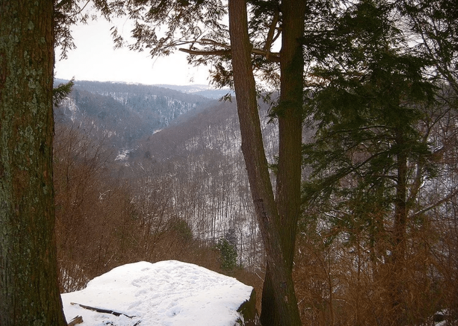
After Grindstone Falls, I drove up to Cleland Rock Scenic Vista, the only worthwhile overlook in the park that I'm aware of. With cloudy skies, it didn't appear that it was going to be a great sunset, so I decided to call it a day and head home. However, if you visit on a clear day, sunsets are supposed to be great here.


Comments