_edited.png)
Swiftcurrent Mountain Lookout: One of Glacier National Park's Best Hikes

Updated: Sep 8
For hikers searching for one of the most spectacular high-elevation adventures in Glacier National Park, few trails deliver quite like the hike to Swiftcurrent Mountain Lookout. Rising to roughly 8,440 feet along the Continental Divide, Swiftcurrent Mountain offers an extraordinary 360-degree panorama over the Many Glacier region, Granite Park, the Livingston Range, the Lewis Range, and some of the park's most impressive glaciers. The journey is long and strenuous, but the constantly changing landscape—from forest and wildlife-rich lakes to alpine meadows, waterfalls, exposed switchbacks, and a windswept mountaintop—makes hiking to Swiftcurrent Mountain Lookout one of the best day hikes in Glacier National Park.

Trail Info
Length 17.5 miles
Elevation gain 3,910 feet
Route Out & back
Permit required no
Dogs allowed no
Trailhead elevation 4,961'
Water filterable from the lakes in Swiftcurrent Valley and two seasonal ponds near Swiftcurrent Pass
Don't miss signing the hiker book at the fire lookout
Hiking to Swiftcurrent Mountain Lookout
For hikers approaching Swiftcurrent Mountain from Many Glacier, the adventure begins near the head of the Swiftcurrent Valley, following the Swiftcurrent Pass Trail west toward the Continental Divide. Parking is available in a large lot behind the Swiftcurrent Motor Inn, with enough space for several hundred vehicles. Despite its size, the lot fills quickly during Glacier National Park's busy summer season, as this area serves as a major hiking hub for several popular trails, including Iceberg Lake and Ptarmigan Tunnel. Hikers should plan to arrive no later than 7:00 AM to have the best chance of securing a parking spot.

From the trailhead, the opening miles are surprisingly gentle compared with what awaits later in the hike, with the trail traveling through forest and alongside a chain of beautiful mountain lakes. This lower section of the Swiftcurrent Pass Trail is also excellent wildlife habitat, so hikers should keep an eye out for moose, deer, black bears, grizzly bears, and other animals common to the Many Glacier area.

One of the first highlights is Fishercap Lake, a small lake tucked beneath the surrounding mountains and one of the best places in Glacier National Park to spot moose. A short spur leads from the main trail to the shoreline, and while visiting adds a little distance to an already long hike, the detour is worthwhile—especially early in the morning when wildlife is often more active.

Beyond Fishercap Lake, the Swiftcurrent Pass Trail continues toward Redrock Lake, where the landscape begins to open and the surrounding mountains become increasingly impressive. Mount Grinnell, Mount Wilbur, and the rugged peaks surrounding the Swiftcurrent Valley dominate the scenery, offering a preview of the alpine terrain ahead. The broad, U-shaped Swiftcurrent Valley is a classic example of Glacier National Park's glacial landscape, carved by enormous Pleistocene glaciers that once filled these valleys with ice.

Near Redrock Lake, hikers can make the short detour to Lower and Upper Redrock Falls, where Swiftcurrent Creek tumbles through a series of cascades and rocky ledges.

From here, the hike continues deeper into the mountains toward Bullhead Lake, with increasingly dramatic views of the massive headwall rising at the end of the valley. Crowds also tend to thin considerably beyond Redrock Falls, giving this stretch of trail a noticeably wilder and more remote feel than the first few miles. As hikers approach Bullhead Lake, Swiftcurrent Glacier begins to come into view, clinging to the rugged slopes along the valley’s towering headwall.

By the time hikers reach Bullhead Lake, the character of the hike begins to change. Dense forest gradually gives way to more open terrain, and the enormous walls surrounding the upper Swiftcurrent Valley become impossible to ignore. Ahead, the Continental Divide rises abruptly thousands of feet above the valley floor, seemingly blocking any reasonable route forward. That apparent dead end is where the real climb begins.

Beyond Bullhead Lake, the Swiftcurrent Pass Trail starts gaining elevation much more aggressively as it approaches the headwall. The trail crosses avalanche paths, rocky slopes, brushy sections, and increasingly open alpine terrain before beginning its long series of switchbacks toward Swiftcurrent Pass.
This historic climb has long been associated with the name "Galen's Ladder," a reference to the extensive switchbacks ascending the eastern side of the pass. The route itself predates the national park and was used by Native Americans before later being traveled by miners and ranchers; major reconstruction of the trail began in 1913.
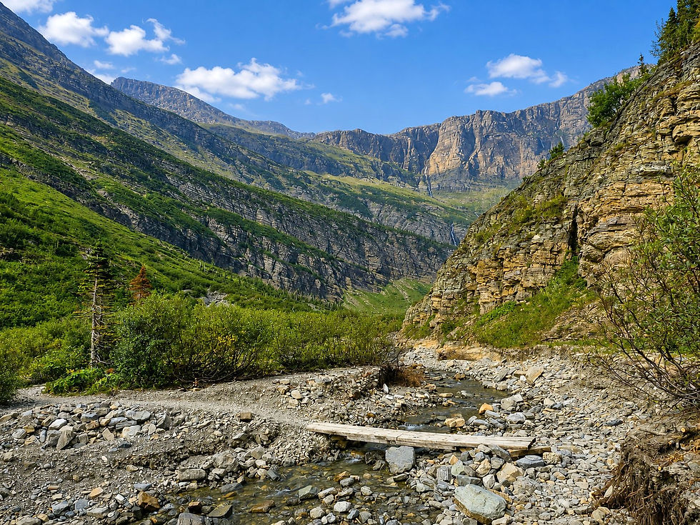

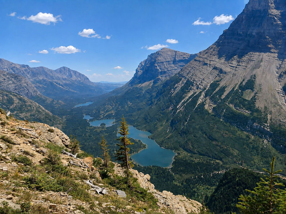
As hikers climb higher, the views back down the Swiftcurrent Valley become increasingly spectacular. Bullhead Lake, Redrock Lake, Fishercap Lake, and Swiftcurrent Lake appear progressively smaller below, forming a string of blue-green lakes stretching east toward the plains.
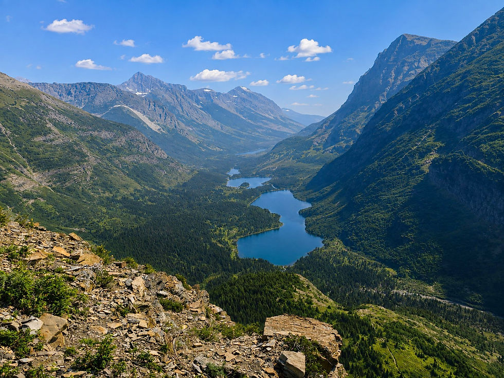
The enormous scale of Glacier National Park becomes especially apparent here, with steep rock walls rising above a valley carved and widened by ancient ice. This section also provides increasingly good views of Swiftcurrent Glacier, which occupies the high country near the Continental Divide. Water draining from snowfields and ice above spills down the surrounding cliffs in thin waterfalls, particularly during early and midsummer. Depending on snowpack and the time of year, hikers may also encounter lingering snowfields near the upper switchbacks.

The final climb to Swiftcurrent Pass is steep, exposed, and dramatically different from the forested terrain encountered earlier in the hike. Vegetation becomes sparse as hikers enter the alpine zone, with low-growing wildflowers and grasses replacing the trees. The trail cuts across steep scree slopes and rocky ledges while switchbacking toward the Continental Divide.
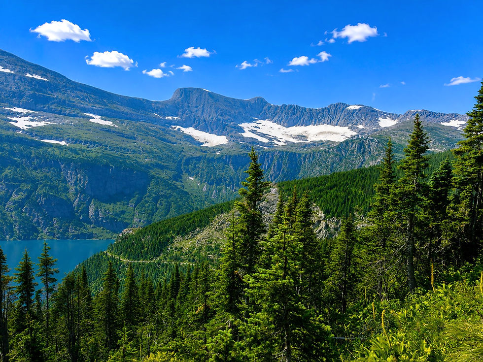

Eventually, hikers crest Swiftcurrent Pass, where the scenery changes almost instantly. Behind you lies the enormous Swiftcurrent Valley and Many Glacier; ahead, the terrain drops toward Granite Park, with the mountains of Glacier's west side spreading across the horizon. Heavens Peak and Longfellow Peak become two of the most recognizable landmarks to the west, rising prominently above the surrounding landscape.

Reaching Swiftcurrent Pass is an impressive accomplishment, but anyone hiking specifically to Swiftcurrent Mountain Lookout still has one final—and substantial—climb ahead. Near the pass, hikers reach the well-marked junction for the Swiftcurrent Lookout Trail. From here, the trail begins climbing the exposed southern slopes of Swiftcurrent Mountain. Unlike the earlier portions of the hike, there is virtually no shade. The route travels through open alpine terrain and loose scree while a succession of switchbacks climbs toward the summit.

The lookout may appear deceptively close from below, but the final ascent is demanding. With every switchback, however, the views become larger. Heavens Peak dominates the western skyline, while the rugged mountains surrounding Logan Pass and the Garden Wall begin appearing to the south. Across the divide, Mount Grinnell and Mount Gould become increasingly prominent, while the ice of Swiftcurrent Glacier is visible beneath the surrounding peaks.
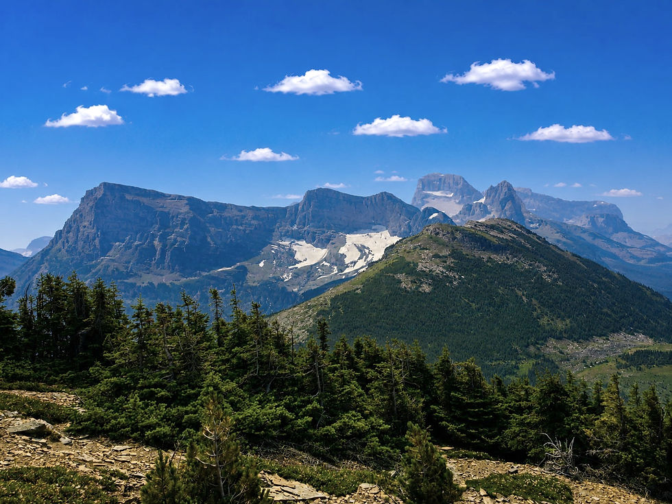
The final switchbacks eventually arrive at the summit of Swiftcurrent Mountain, where the historic Swiftcurrent Mountain Lookout sits at roughly 8,440 feet. The small stone structure blends remarkably well into the rocky summit and occupies one of the finest lookout locations anywhere in Glacier National Park. From this point, there are virtually unobstructed views in every direction. The lookout also marks the highest point in Glacier National Park that hikers can reach via hiking trail.

Looking east from Swiftcurrent Mountain Lookout, hikers can trace nearly the entire route they just climbed. Far below, the lakes of the Swiftcurrent Valley form a beautiful chain leading toward Many Glacier and eventually the open plains east of the park.
To the south and southeast, the view is even more impressive. Mount Gould, Mount Grinnell, and Mount Siyeh rise around the Continental Divide, while Swiftcurrent Glacier rests beneath the Garden Wall. Farther south, hikers can pick out the rugged high country surrounding Logan Pass, with additional peaks stretching toward Mount Reynolds, Clements Mountain, and Bearhat Mountain.
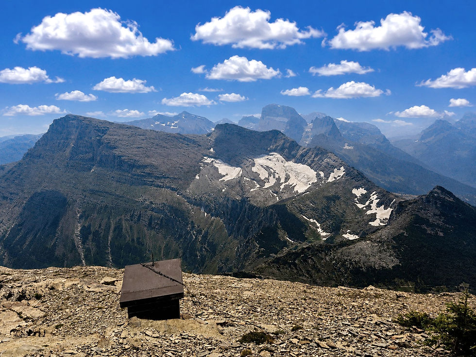
To the north, hikers can look toward North Swiftcurrent Glacier, tucked beneath the high ridges north of the summit. Beyond it, the mountains of the northern Lewis Range stack against the horizon, including Ipasha Peak and, on exceptionally clear days, Mount Cleveland, which at 10,466 feet is the highest mountain in Glacier National Park.

On an exceptionally clear day, the summit panorama can encompass dozens of major peaks, multiple glaciers, and numerous lakes, making Swiftcurrent Mountain one of the finest natural observation points in Glacier National Park. The summit's position directly along the Continental Divide is what makes the view so remarkable: hikers are essentially standing between two completely different landscapes, with the greener, forested mountains of western Glacier on one side and the enormous glacial valleys of Many Glacier dropping toward Montana's plains on the other.
The summit is also a good place to appreciate just how thoroughly glaciers shaped this landscape. The deep U-shaped valleys, steep headwalls, knife-edge ridges, cirques, and chains of alpine lakes visible from Swiftcurrent Mountain are remnants of enormous glaciers that once covered this part of the Northern Rockies. Today's much smaller alpine glaciers formed thousands of years ago and expanded significantly during the Little Ice Age before beginning their modern retreat around the mid-1800s.
After taking in the views from Swiftcurrent Mountain Lookout, hikers can retrace their steps down the lookout trail to Swiftcurrent Pass before beginning the long descent into Many Glacier. The return trip provides a completely different perspective, with the Swiftcurrent Valley spread out almost continuously below during the descent from the pass. Those tackling the hike as an out-and-back should save plenty of energy for the return—the mileage, elevation change, rocky terrain, and prolonged descent make this a demanding full-day adventure even for experienced hikers.
For hikers with the fitness and time to take it on, however, hiking to Swiftcurrent Mountain Lookout via Swiftcurrent Pass is one of the most rewarding hikes in Glacier National Park. Few trails combine so many of the park's defining features into a single adventure: wildlife-rich lakes, waterfalls, forests, glacial valleys, alpine meadows, historic switchbacks, active glaciers, the Continental Divide, and a mountaintop fire lookout surrounded by some of the most spectacular scenery in the Northern Rockies. It's a strenuous journey, but for those willing to make the climb, the view from Swiftcurrent Mountain is one that is difficult to match anywhere in Glacier National Park.


Comments