_edited.png)
Hiking the Nuthatch Trail: A Walk Through Centuries of Akron History
Hiking the Nuthatch Trail in Sand Run Metro Park offers a 3.3-mile journey through one of Akron’s most historic natural areas. Formerly known as the Mingo Trail, the route climbs through mature forest while revealing a landscape shaped by centuries of Indigenous history and the nearby Portage Path. The trail also connects Sand Run Metro Park with F.A. Seiberling Nature Realm, allowing hikers to explore two of Summit Metro Parks’ most scenic parks on foot. With challenging terrain, beautiful woods and fascinating local history, the Nuthatch Trail is one of the most rewarding hikes in the Akron area.

Trail Info
Length 3.3 miles
Elevation gain 395 feet
Route Loop
Permit required No
Dogs allowed No
Trailhead elevation 1,029'
Water spigots at F.A. Seiberling Visitor Center, Chestnut Lodge, and Parkway Jogging Trail
Don't miss a visit to the F.A. Seiberling Nature Realm Visitor Center before or after the hike
Hiking the Nuthatch Trail
The hike begins at F.A. Seiberling Nature Realm, one of Akron’s most scenic and historically significant parks. The Nature Realm has a large parking area capable of accommodating dozens of vehicles, although spaces can fill quickly on busy weekends.

While there is no dedicated Nuthatch Trail trailhead within the Nature Realm, several trails can be used to reach it. The most common approach follows a combination of the Cherry Lane and Fernwood trails, offering a scenic introduction before leaving the Nature Realm and continuing into the more rugged forests of Sand Run Metro Park.

The Nuthatch Trail is one of the more rugged and historically interesting hikes in the Akron area. The trail descends through a mature forest of oak, beech and tulip trees, traversing steep hills and narrow sections of trail before connecting with neighboring Sand Run Metro Park. Formerly known as the Mingo Trail, the route also passes through a landscape with deep Indigenous history tied to the nearby Portage Path, making this much more than simply a walk through the woods.

Sand Run Metro Park itself dates to 1929, when it opened with nearly 700 acres. Much of the land that made the park possible came from F.A. Seiberling, co-founder of the Goodyear Tire & Rubber Company and one of the driving forces behind the creation of Akron's early metropolitan park system. Seiberling proposed donating a large portion of his property for parkland in 1924, and his contribution formed the core of what eventually became Sand Run Metro Park.

The landscape's history, however, reaches back centuries before Sand Run became a park. Long before Akron existed, Indigenous peoples traveled through this portion of Northeast Ohio. Nearby Portage Path was an important Indigenous travel route connecting the watersheds of the Cuyahoga and Tuscarawas rivers. In practical terms, the portage helped connect two enormous drainage systems: waterways leading north toward Lake Erie and those leading south toward the Ohio River and ultimately the Mississippi River.

That made the area surrounding present-day Sand Run an important travel corridor. Even the land surrounding today's Chestnut Lodge was once used as a campsite by Indigenous peoples hundreds of years ago. Portage Path later took on another significance following the Treaty of Greenville in 1795, when the historic route became part of the boundary between lands claimed by the United States and lands reserved to Indigenous peoples.
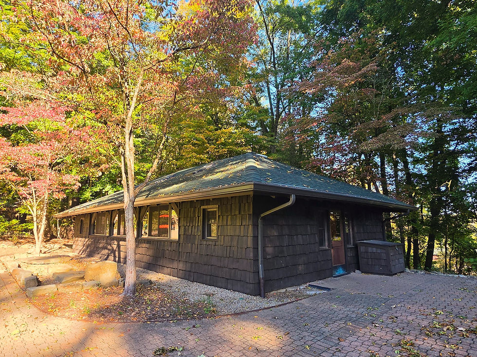
It's an important piece of context when hiking Nuthatch Trail. Although today you're following a recreational trail through a protected forest, people were moving through this general landscape long before Summit Metro Parks existed. The ridges, valleys and waterways around Sand Run were part of a much older human landscape.
That history also helps explain the trail's former name.
For decades, Nuthatch Trail was known as the Mingo Trail, while nearby Chestnut Lodge was called Mingo Lodge. Older interpretations connected the name with Indigenous people believed to have used the area. More recent research by Summit Metro Parks, however, found that the name did not accurately convey the complicated Indigenous history it was intended to represent.

"Mingo" was not the name of a single, clearly defined Indigenous nation in the way older interpretations sometimes implied. The term was historically applied to Indigenous people in the Ohio Country with connections to several communities, particularly Haudenosaunee peoples. As Summit Metro Parks reevaluated historical place names, its cultural-resource staff consulted archaeological research, historical records and Indigenous representatives and concluded that continuing to use the Mingo name was not the best way to interpret the history of the area.
The park district eventually renamed Mingo Trail the Nuthatch Trail, while Mingo Lodge became Chestnut Lodge. Rather than erasing the Indigenous history of Sand Run, the change was intended to allow that history to be presented more accurately and without attaching an overly simplified label to the people who once traveled and camped here.

The new trail name comes from one of the little birds hikers may encounter in the surrounding forest. White-breasted nuthatches are common throughout Northeast Ohio, while red-breasted nuthatches can occasionally be found around larger stands of conifers. The birds spend much of their time moving along tree trunks and branches, searching beneath bark for insects and caching seeds that they can return to during the winter. Their calls can be heard throughout the wooded areas of Sand Run.

The trail itself has been part of Sand Run's hiking tradition for generations. We know it existed as the Mingo Trail by at least 1965, when it was selected for the very first official hike of the newly organized Metropolitan Parks Hiking Club. On June 27 of that year, hikers gathered at Sand Run for an outing along what was then described as the 2.5-mile Mingo Trail. That places the trail among the longstanding hiking routes in Summit Metro Parks.
It also dates to an era when Sand Run already bore the unmistakable imprint of the Civilian Conservation Corps. During the 1930s, CCC crews transformed portions of the park by constructing Sand Run Parkway along with shelters and other structures.
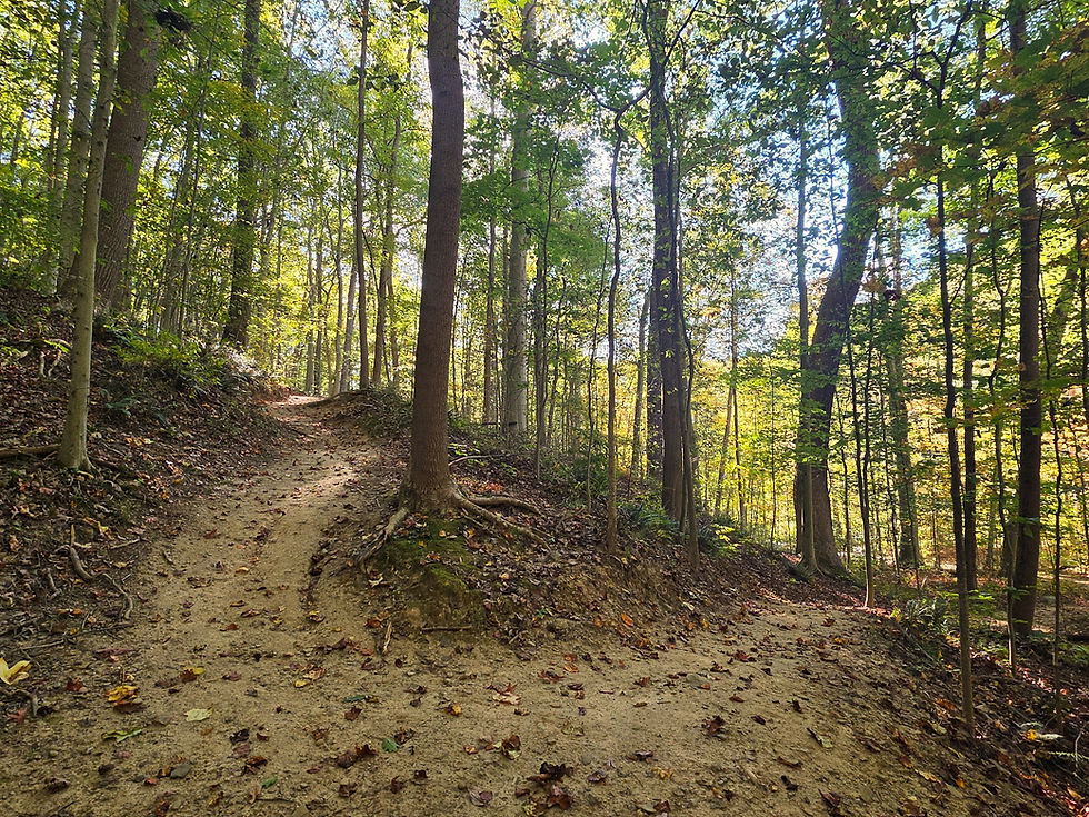
Today, Nuthatch is one of Sand Run's more demanding hikes. Rather than remaining in the relatively level bottomlands surrounding Sand Run Parkway, the trail climbs the hills above the valley, providing plenty of elevation change along the way. Those climbs are also what make one of the trail's most interesting features possible.
Near the top of the valley, Nuthatch Trail connects directly with F.A. Seiberling Nature Realm, effectively linking two of Summit Metro Parks' best-known natural areas by foot. That connection is especially fitting because the histories of the two parks are intertwined.

F.A. Seiberling donated more than 400 acres that helped expand Sand Run Metro Park, while another piece of property he owned from 1920 until 1948 was purchased by the park district in 1964. That land became F.A. Seiberling Nature Realm, which was dedicated in the 1960s and became home to the park district's first nature center.
A hiker can therefore use Nuthatch Trail to travel between two landscapes that owe much of their preservation to the same man. On one side is Sand Run, one of the park district's earliest major preserves; on the other is the Nature Realm, established decades later on another piece of former Seiberling property.

Hikers extending their trip into the Nature Realm can connect with its trail system and explore features such as Echo Pond, Seneca Pond, gardens, prairie and the park's well-known suspension bridge over a 45-foot-deep ravine. One important thing to remember, however, is that dogs are not permitted within F.A. Seiberling Nature Realm, including for hikers entering from Nuthatch Trail.

Back in Sand Run, the surroundings become noticeably wilder. Cool ravines support ferns, hemlocks, skunk cabbage and colonies of horsetails, while spring brings trillium, bloodroot, spring beauty, trout lily and other wildflowers. The surrounding forest provides habitat for everything from squirrels and pileated woodpeckers to barred owls, great horned owls and red-tailed hawks.

That combination of rugged terrain, mature forest and history is ultimately what makes Nuthatch Trail stand out. It's possible to hike the route simply for the exercise and scenery, but knowing the story behind the landscape gives the trail considerably more meaning.

You're hiking through one of Summit Metro Parks' earliest preserves, across land closely associated with F.A. Seiberling and within a park transformed by Depression-era conservation projects. You're following a trail that was known as Mingo for generations and hosted the Metropolitan Parks Hiking Club's first official hike more than 60 years ago. And near the top of the valley, you can literally walk from Sand Run into F.A. Seiberling Nature Realm, connecting two pieces of Akron's conservation history on foot.
Most importantly, though, the history of this landscape did not begin with the creation of a park. Long before recreational hikers climbed these hills, Indigenous people traveled, camped and moved through the Sand Run area, using nearby Portage Path as an important connection between major watersheds.
Remembering that deeper history adds another dimension to the hike: Nuthatch Trail isn't simply a path through the woods, but a walk through a landscape that has connected people and places for centuries.
A few things are worth knowing before setting out on the Nuthatch Trail. Some popular hiking apps have not yet been updated to reflect a recent trail reroute near the Parkway Jogging Trail in Sand Run Metro Park. If hiking the loop clockwise, pay close attention to trail markers and watch carefully for the turnoff from the Jogging Trail back onto the Nuthatch Trail, as it can be easy to miss if you are relying solely on a GPS route.
Also keep in mind that the F.A. Seiberling Nature Center operates on limited hours and is typically closed on Mondays and Tuesdays. If you are hoping to stop inside before or after your hike, check the current hours ahead of time.


Comments